From the moment Google “placed our world online”, geolocation services have undergone a significant transformation regarding functionality, visual quality and purpose. Now geolocation is widely used by companies to steer in customers or visualise their movement.
The problem is Google Maps, or similar geo services, meet only some general mapping and positioning requirements, but they are not suitable for highly-specific geospatial planning and custom visualisation. The alternative solution is a geographic information system (GIS) platform — a tool that enhances the capabilities of public mapping services with unlimited customisation potential.
A rare case when one-size-fits-all really works
A GIS Platform created by ELEKS is among those few geo-location technologies on the market that serve as an ultimate solution for custom mapping and visualisation tasks for industries with complex operating models. It allows one to deploy and integrate geo services into any application as well as easily create customised indoor maps, manage all the content and bind the contextual data to the map.
Here are a few examples of what companies from various industries can do with such a tool at their disposal:
- agriculture companies can geo-fence their fields, create map layers for different fieldworks and their areas or track the operation of autonomous harvesters;
- real estate enterprises can visualise properties, display their attributes in visual form, highlight specific surroundings and generate cooperation with their agents and clients quickly and transparently;
- logistics service providers can calculate routes and distances, track the progress of long-distance and last-mile deliveries, plan and mark warehouse space;
- insurance companies are able to visualise location intelligence, mark areas and assets with high-risk exposure rates and display location-based insurance rates and policies to their clients — all this with automatic synchronisation and real-time updates.
In addition to universal visualisation and layout capabilities, the GIS Platform is built to support extensive integration options. For example, its communication with a Mobile Platform can provide for instant map updates from mobile or IoT devices, which is very convenient for remote locations.
A quick peek under the hood
Let’s have a closer look at the GIS Platform components and their functions within the solution.
GIS Platform architecture
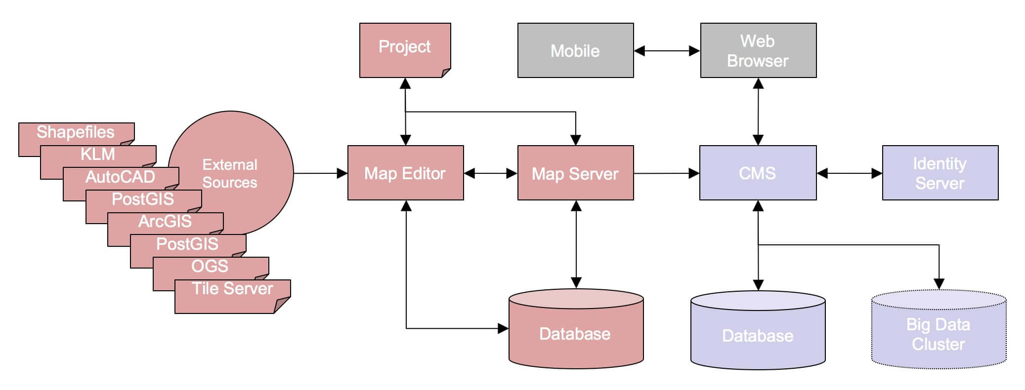
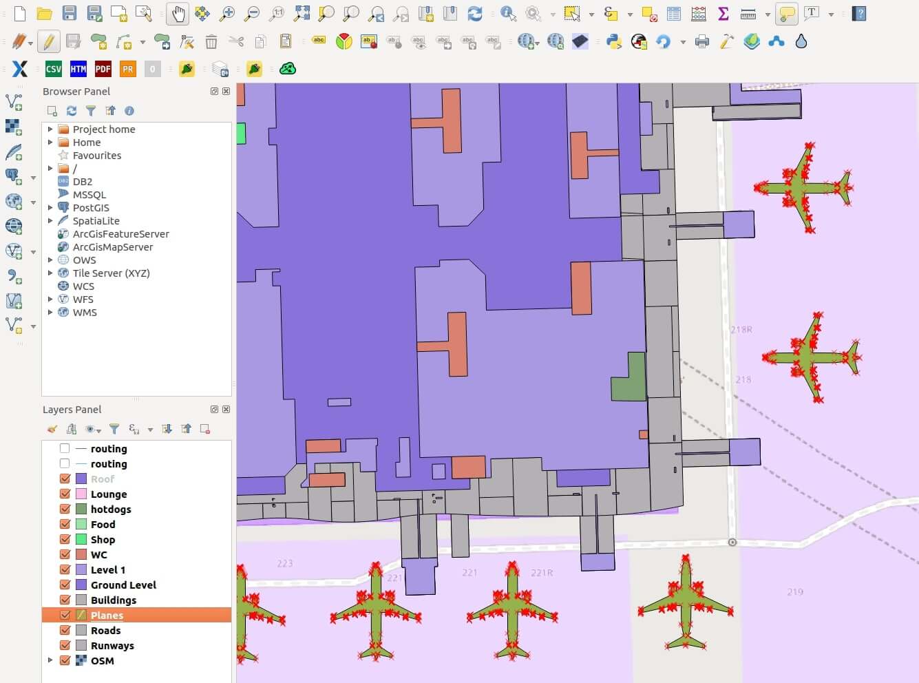
Map Editor. It’s an environment where you can create your map projects from different sources (OSM, PostGIS, ESRI shapefiles, Archicad models, KML, geoJSON etc.), define the layer structure of the map, configure the rendering behaviour, colors, visibility for these layers, also provide access to map server configuration, determine the basic OWS services. All the geometry data is stored in a separate PostGIS database while the map structure, colors and OWS configuration — in the project file.
Map Server. The OWS server provides standard mapping services based on WMS, WFS and WCS protocols. Additionally, the server functionality can include the routing and PDF printing services etc.
Content Management System (CMS). It’s a place where your content sticks to the map provided by the map server. The content data is placed in a separate database to avoid data blending. It makes the system more reliable and removes a single point of failure. For scaling though, it is better to use the Big Data cluster, especially if the content data is very diverse and contains video, audio, images, documents etc.
Identity server. To fulfill multi-tenancy needs, the identity server supports and distributes different user roles. By managing these roles and permissions, you can allocate and filter the content data for various groups.
Web & Mobile. The final result is visible via a web browser or can be wrapped into a webview component and embedded into native mobile apps.
GIS Platform features
Map Editing. With the help of the GIS Platform, you can create custom geospatial content composed of data from external public sources and devise your custom content on top of it, such as an indoor map with shops, registration decks for airports, rooting for indoor navigation, underground utilities, heat maps and virtually anything you can think of. The Platform allows you to easily edit the data about your assets in real-time, ensuring that customers, contractors and employees get up-to-date information about your services.
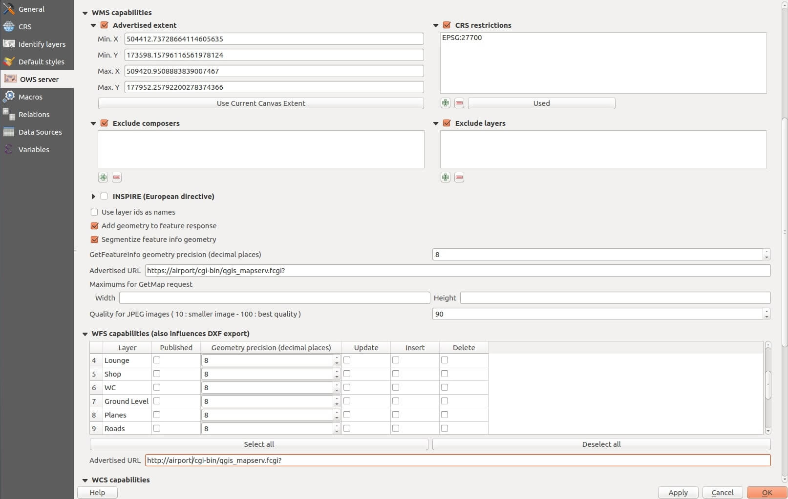
Map server setup. The map content can be published via an OWS server, where the provider defines the public interface for regular services such as WMS, WFS and WCS. In the image below, you can see an administration panel for the map server:
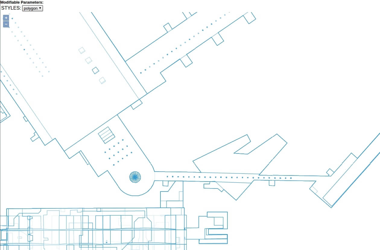
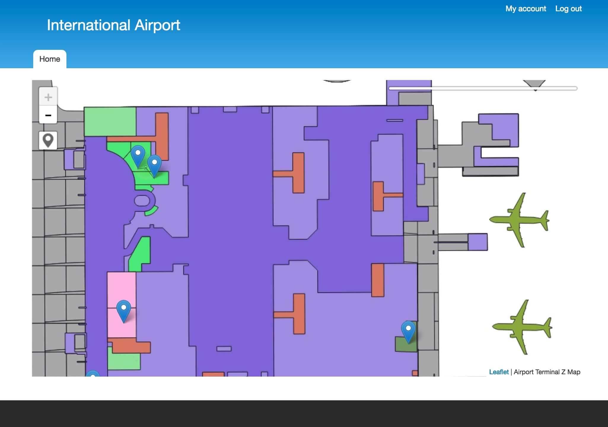
Vector support. To optimise the network load, the OWS server supports a vector tile format. It allows to decrease the amount of transferred data by 75%, in comparison to the traditional, raster formats. The given image shows the map of an airport rendered in the vector format. The layer colours are disabled.
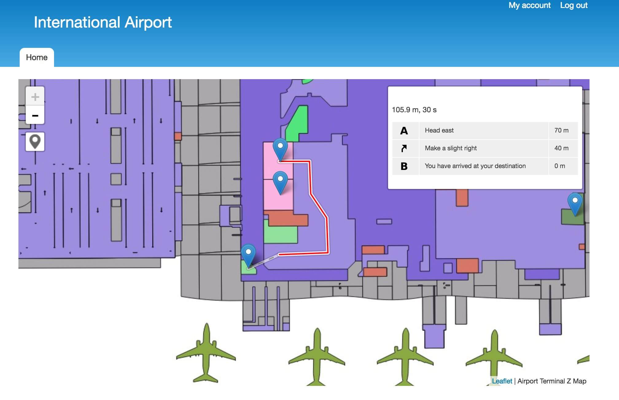
Content Management System. CMS is the glue that binds together your spatial data with the certain piece of content (video, images etc.) and sticks it to the map. The information about the location can be displayed in various ways – with pinpoints, popups, routings etc. (see the pictures below).
Multi-tenancy. The platform has an option to set different types of access and permission to the content data. In just a few clicks, you can create custom roles and give your employees the rights to administer the services, no matter what device the person signs in from. It allows you to orchestrate all the processes in a centralised way, yet remain flexible and ensure the right people have access to the right data.
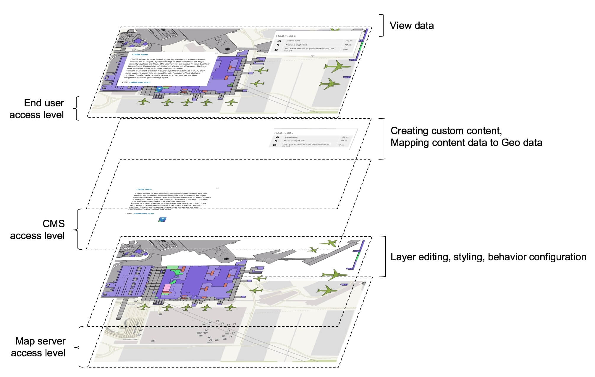
Data layer decomposition demonstrates multiple levels of access to information. The Map Server is isolated within a separate access level where the map provider can administer the custom map content.
Also, CMS has another access level where the administrator can configure different permissions for various user groups. For example, give permission to authorised users to create and modify information about your shops in malls and airports.
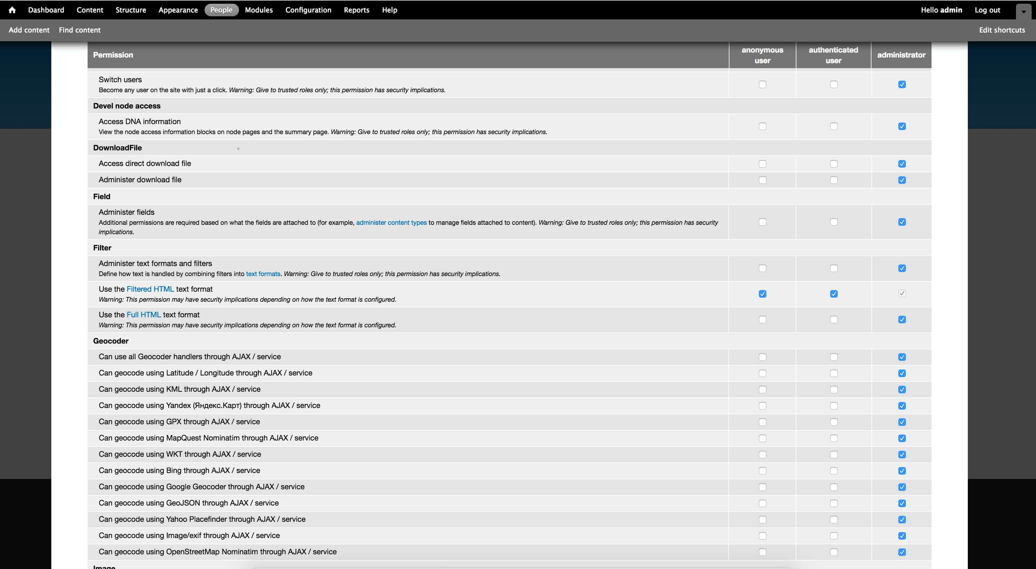
For anonymous users, the system can provide access to routing for indoor navigation, viewing and filtering of the content uploaded by authorised users. The image below illustrates the access options for the various user roles:
Mobile support. The significant advantage of ELEKS’ GIS Platform is that it supports mobile devices. The content can be displayed through the mobile web or embedded into native mobile applications. Moreover, you can integrate ELEKS’ Mobile Platform SDK (Software Development Kit) for data analysis, where you can collect data from the mobile phone such as GPS tracking, cookies etc.
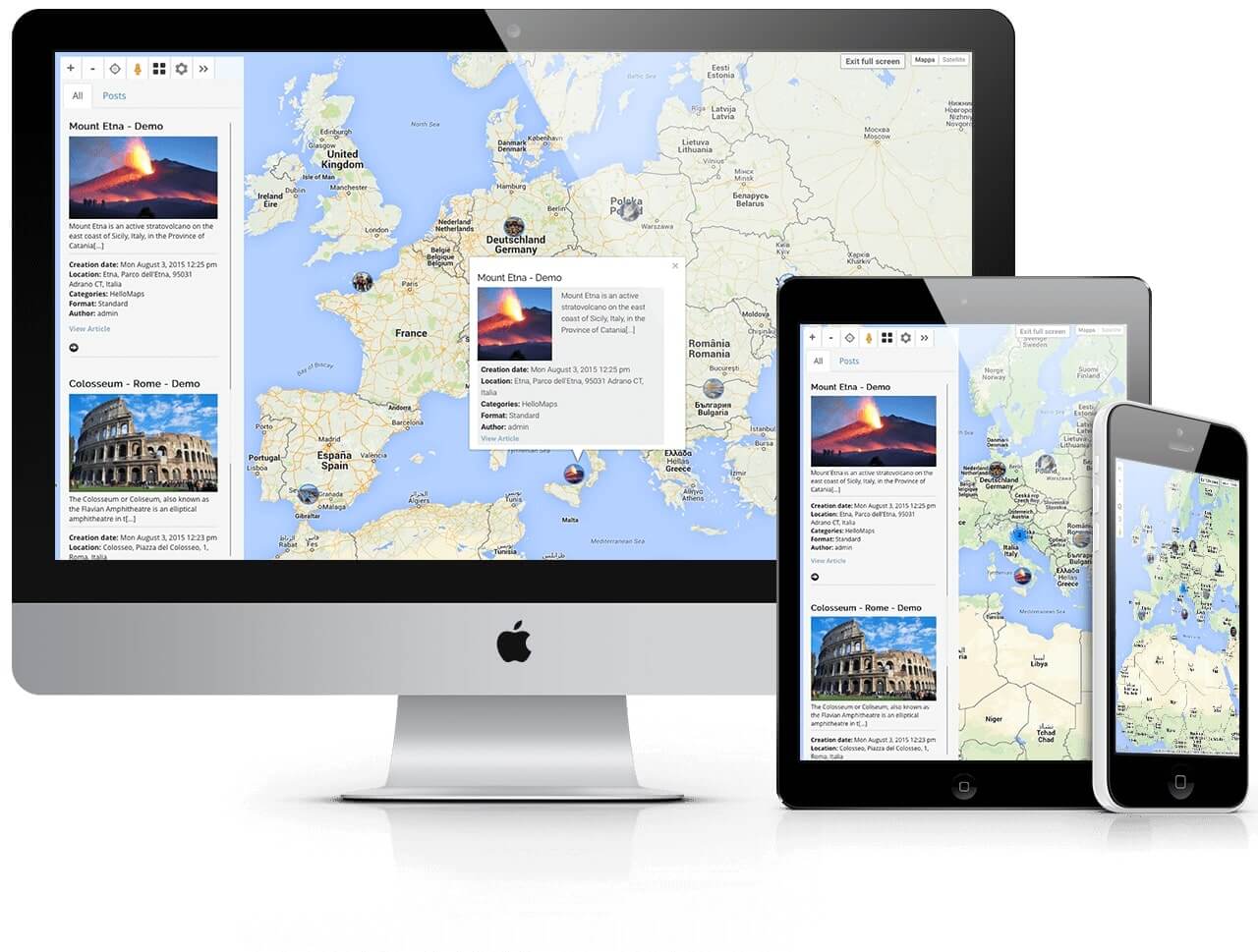
Mobile support
In the right place at the right time
The GIS Platform can become your ultimate in-house toolkit, helping you supply your customers with comprehensive information, cut operating costs through better planning and visibility, improve resource allocation, streamline information flow within your company, increase employees’ productivity and safety and last, but not least, make the decision-making process more data-driven, thus more accurate and efficient. Also, the Platform reduces reliance on public mapping services such as Google Maps, allowing you to follow your own unique visual style guidelines, improve the customer’s journey and, as a result, award your business with another prominent differentiating feature.
As the American businessman Jack Dangermond, one of the pioneers in the development of GIS, once said, “The application of GIS is limited only by the imagination of those who use it.”
Get in touch to learn more about our enterprise applications and discuss the opportunities the GIS Platform can offer your business.
Related Insights


